Your Complete Guide to
Drone Services
From site selection to project close-out, explore every drone service available to Ryan Companies. This interactive playbook covers all three phases of construction.
Pre-Construction
Before the first shovel hits the ground, our drones are already at work. Site selection, monitoring, zoning support, and 3D rendering services help you plan with confidence.
Site Selection
Rather than looking at outdated Google Maps, our drone pilots are able to fly a prospective site without you having to leave the office while still getting a detailed, up-to-date view of the property you're considering for your next job site.
Site Monitoring
By creating a map or doing a video flyover, we can document the conditions of the roads before your trucks and heavy equipment show up. This provides valuable legal documentation and baseline conditions.
Zoning Meetings
Rather than waiting for the zoning board to send someone out to visit your site, be proactive and bring the site to them with detailed aerial imagery and maps.
360 Rendering Video
We can provide drone footage of empty land and overlay a 360 model of your new building as if it already exists — a powerful tool for stakeholder presentations and approvals.
Construction
During active construction, our services keep every stakeholder informed. From weekly progress captures to precision mapping and facade inspections.
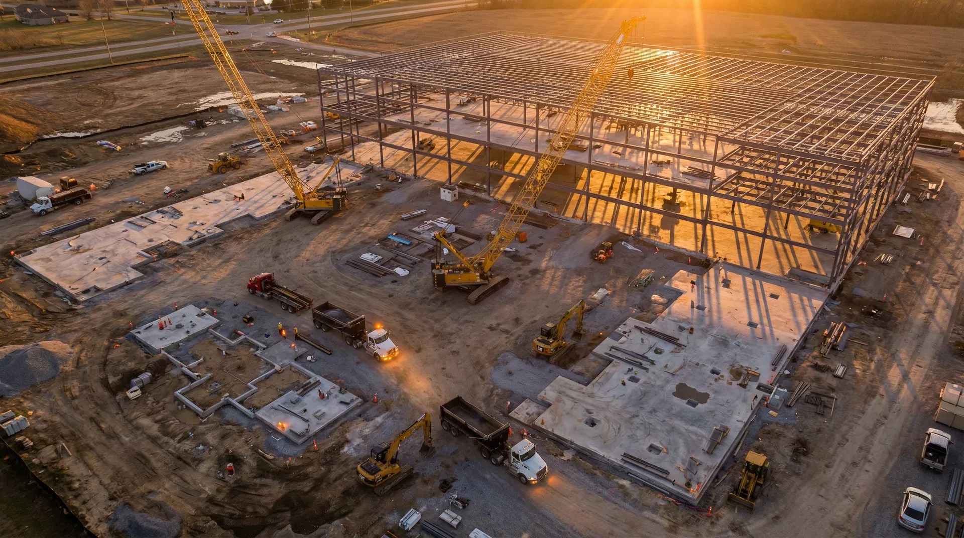
Progress Photos & Videos
Progress photos and videos help document all phases of construction over time and keep your stakeholders, investors, owners, GCs, subs, clients, banks, insurance companies, and municipalities updated.
Jobsite Map Print Outs
While our job site maps are all available digitally, many prefer to roll out a map. Cover the walls in the job trailer with weekly maps we create so you can see your job progress come to life.
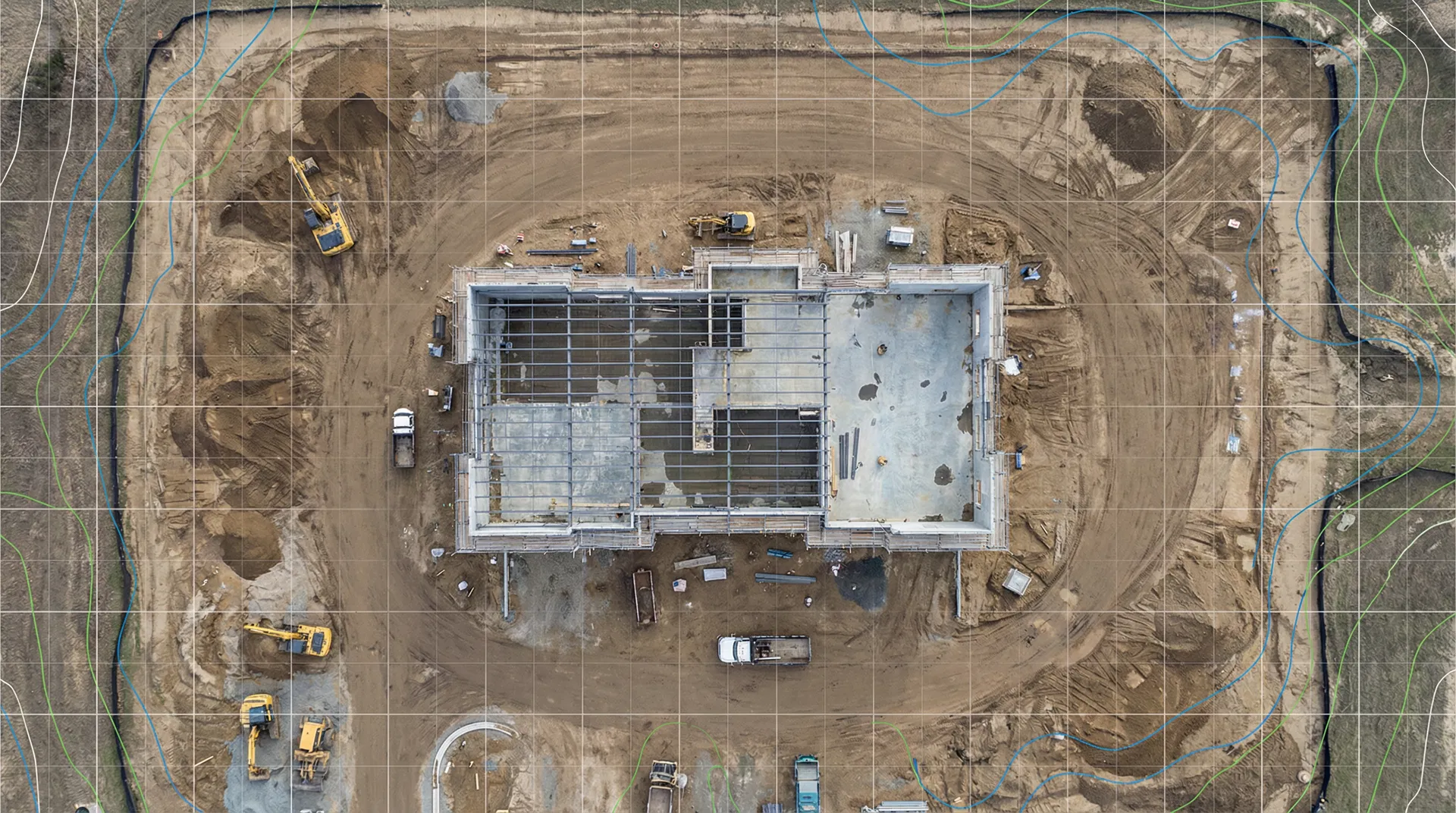
Stockpile Measurements
Want to know how many trucks you will need to haul away the piles of crushed concrete on your job site? Our stockpile measurement technology is a game changer for accurate volume tracking.
Cut-Fill Analysis
Our team can help with cut-fill analysis to help you save considerable time and money on earthwork. Compare planned grades with actual terrain to optimize material movement.
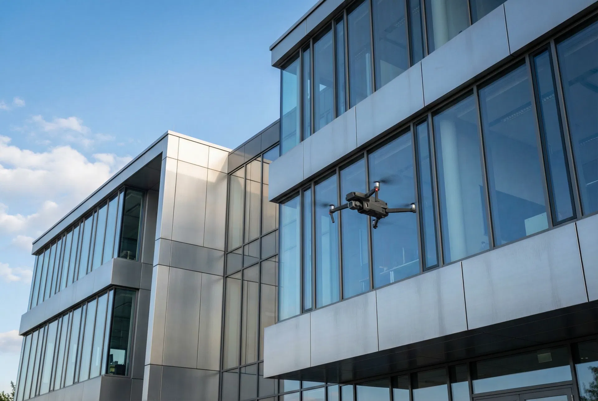
Facade Inspection
Reality capture allows you to efficiently check the installation and quality of work at key exterior milestones. Send drones on autonomous inspection missions to capture building exteriors, keeping team members out of dangerous conditions.
Ground Control Points
Add Ground Control Points (GCPs) to any site to capture pinpoint accuracy and analyze your job site progress from the large scale to the minuscule.
Site Plan Overlays
We can import your site plan as a separate layer in our drone maps or we can export our contour maps for use in your CAD system. Up to 3 site plan overlays per map.
Integrations
Integrate with all of your technologies including ProCore, AutoCAD, and much more. We'll help you streamline the use and sharing of drone assets across your entire project team.
Milestone Captures
Drones make for a great tool to capture your team, your client, and local government officials with their hard hats and shovels for the groundbreaking ceremony. Create videos to use in all social media and marketing efforts.
Post-Construction
After the build is complete, we help you document the finished product, create training materials, and produce marketing content that showcases your work.
Interior & Ground Captures — Drones
We capture interiors with a drone fly-through; great for large-scale warehouse-type projects (100,000+ sq ft) as well as more detailed FPV (First Person View) tours.
Interior & Ground Captures — 360 Camera
Our pilots are trained in using 360 cameras to capture and upload interior and ground assets. Struction Site is now part of DroneDeploy — delivering incredible detail utilizing the world's most flexible digital twin platform.
System Training Videos
With our nationwide team of videographers, we can help capture and produce system training videos for you to hand over to your clients.
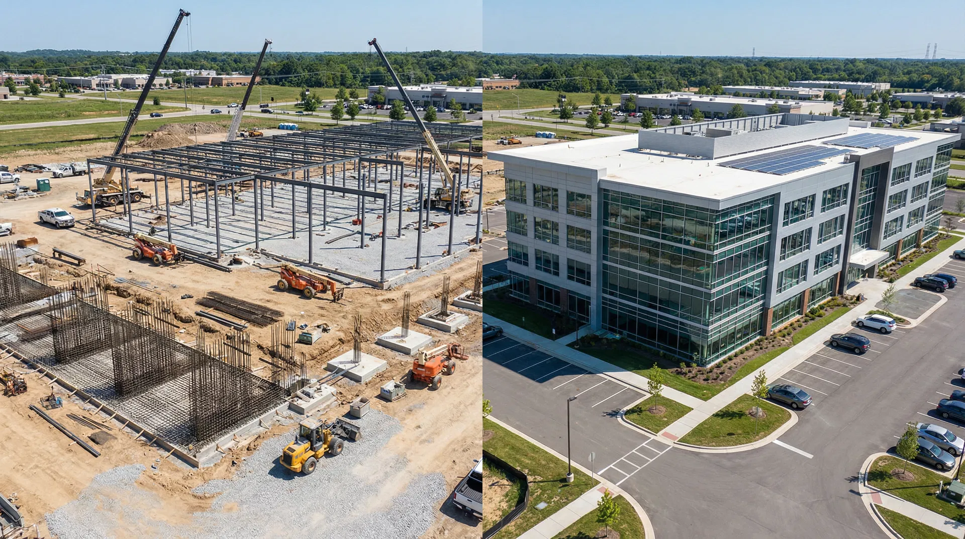
End of Project Time Lapse
Time lapses are a great way to show off your work, impress existing clients, and show prospective clients the caliber of your work. A compelling visual story of your project from start to finish.
Final Project Tour & Marketing
Highlight the years of hard work your company invested in order to complete a building. The photos and videos that we capture will give you and your clients spectacular images to use in all your marketing and social media.
Building Inspections
Safely, efficiently, and quickly conduct building inspections with the help of our expert drone pilots and visual mapping services. The results of an aerial inspection offer a way to safely present a more fully developed scope of work.
Service Packages
All packages include 1 hour of drone and pilot time, travel, insurance, cloud storage, and coverage for up to 100 acres.
Note: To add interior flights to Site Intelligence, see Progress Documentation + pricing above. All pricing subject to project specifics.
Ready to Get Started?
Contact our team to schedule your first flight or discuss a custom package for your Ryan Companies projects.